|
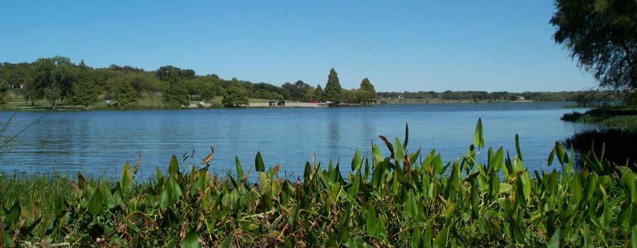
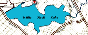
Lily Pad Bay, ringed by natural vegetation, lies within an arc of the lake's shoreline, between Miji (formerly Jackson) Point and Tee Pee Hill.
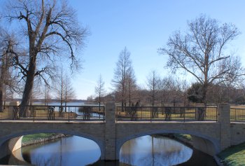
Two apparently nameless creeks flow into the bay from the west. Motorists driving on West Lawther Drive pass over the southernmost stream using a small concrete bridge that was built by the WPA between 1935 and 1937. A more recently-constructed wooden bridge, for foot traffic, also passes over it. A recently constructed masonry bridge spans the northernmost creek.
There are paved parking areas on the north, west, and south sides of the bay. The largest lot is on the north side.
|