
1937 Civilian Conservation Corps Planning Map
|
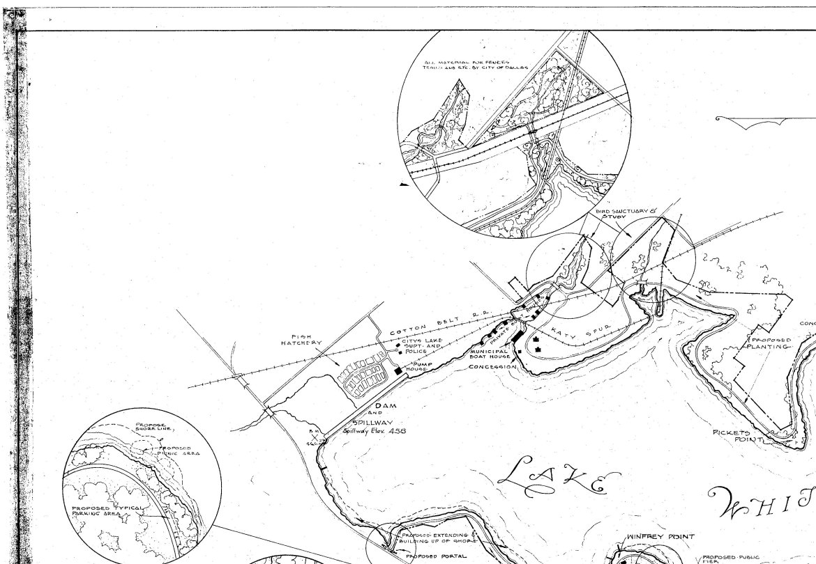
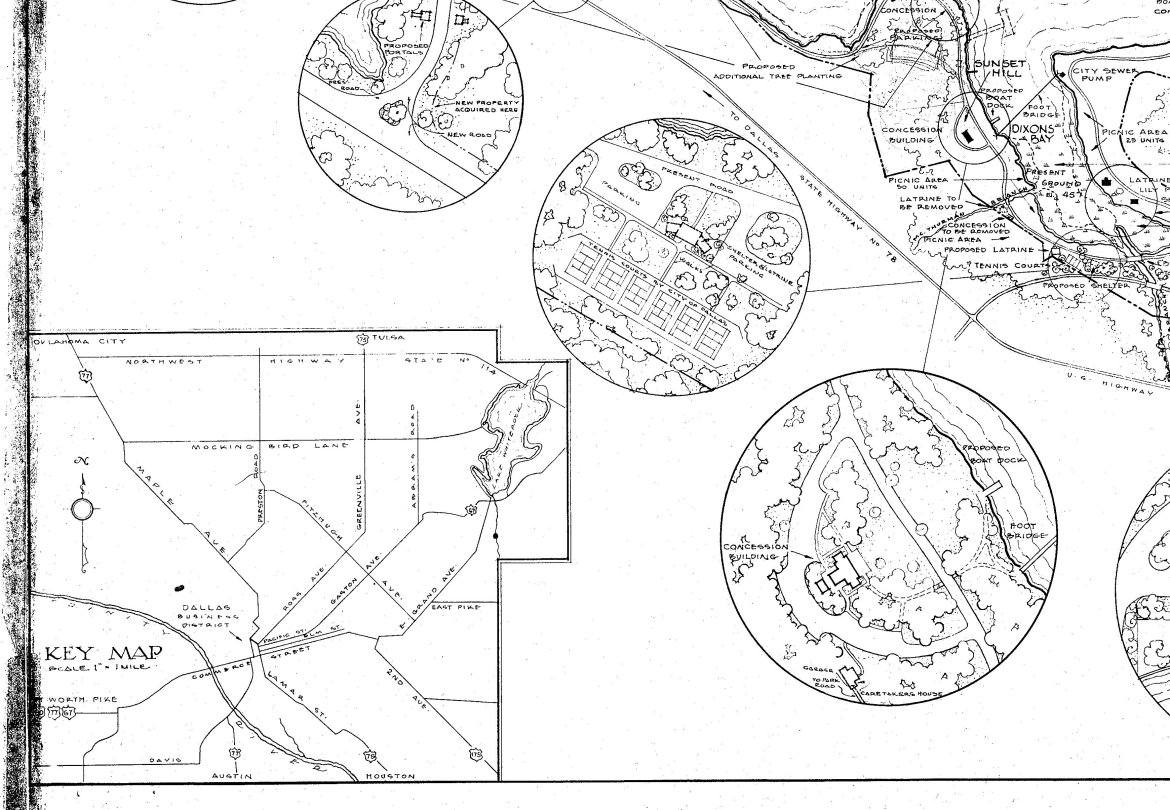
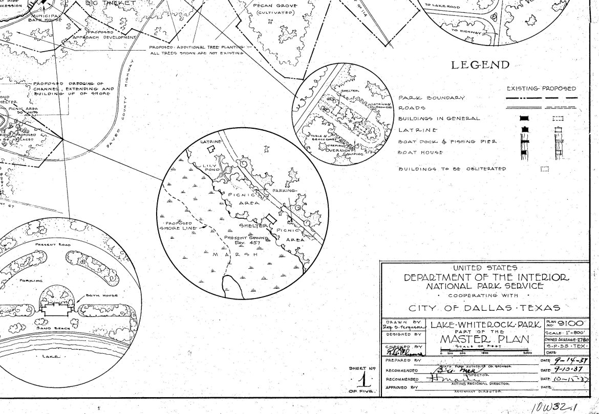
This map, drawn in 1937 by Architect M. A. Burke of the National Park Service, shows many of the Civilian Conservation Corps projects, both completed and proposed, for White Rock Lake Park. It is here divided into 4 sections for a quicker download time. To view close-ups, click on each section "thumbnail." Use your browser's "BACK" button to return to this page.
Map courtesy City of Dallas Archives. Map scan courtesy Jay Firsching, Architexas. This website copyright © 1996-2017 by Steven Butler, Ph.D. All rights reserved. |